West Highland Way
From Shelf: Walking guides from Vertebrate Publishing
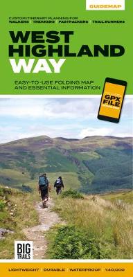
West Highland Way Guidemap from Vertebrate Publishing is a lightweight, waterproof, durable and easy-to-use folding map with 1:40,000-scale mapping for the south to north WHW route. Includes route variations, an elevation profile and route planner, safety advice, terrain information and accommodation directory, and a GPX file download.
The 153-kilometre West Highland Way encompasses the variety of Scotland's wild places. The route, which begins in Milngavie and finishes in Fort William, passes from Glasgow, Scotland's friendliest city, through lochs and forests, and across wild moors in the shadows of Munros. Offering panoramic views and clear waymarking, it is no wonder this is one of Scotland's most popular long-distance routes. The West Highland Way appeals to people who have different levels of experience and travel at all speeds, and this Vertebrate Publishing Guidemap is unique in that it caters for four categories of user, providing custom itineraries for walkers, trekkers, fastpackers and trail runners.
This lightweight, waterproof, durable and easy-to-use folding map features all the essential information for a successful West Highland Way, including 1:40,000-scale mapping for the linear route starting in Milngavie and finishing in Fort William. It also includes a detailed elevation profile and route planner, safety advice, terrain information and an accommodation directory, and a link to a GPX file download.
RRP: £14.95
Format: Sheet map, folded
ISBN: 9781839810329